S-100IHO Universal Hydrographic Data Model
The S-100 standard provides a theoretical framework of components that are based on the ISO 19100 series of standards and specifications. These standards and specifications are also used as the basis for most contemporary geospatial standards Development activities and are closely aligned with other standards development initiatives such as the Open Geospatial Consortium (OGC).
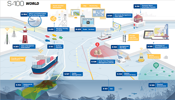
S-101Electronic Navigational Chart(ENC)
.png)
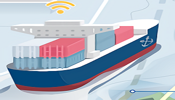
An Electronic Navigational Chart (ENC) is a vector chart produced on the authority of a government authorized Hydrographic Office or other relevant government institution. Its primary purpose is for use within an Electronic Chart Display and Information Systems (ECDIS) to meet International Maritime Organization (IMO) and Safety of Life at Sea (SOLAS) chart carriage requirements. The ENC contains an extraction of real world information necessary for the safe navigation of vessels
S-102Bathymetric Surface

The Bathymetric Surface Data Product consists of a set of grid value matrix values organized to form a quadrilateral grid coverage with associated metadata representing a bathymetric depth model for an area of the sea, river, lake or other navigable water. The data set includes both depth estimate values and uncertainty estimates associated with the depth values. In addition a discrete point set called a "tracking list" allows a hydrographer to override any particular grid matrix value to deliberately bias the data for safety of navigation. That is, the data set can carry both measured depth information that may be used for scientific purposes as well as corrected depth information that may be used for navigation.
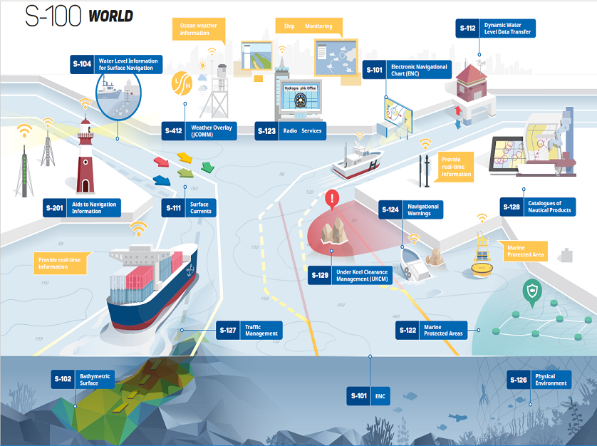
S-104Water Level Information for Surface
Navigation
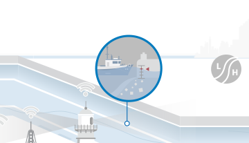
The S-104 Water Level Information for Surface Navigation is intended the encapsulation and data transfer of tidal and water level data for use in an ECDIS or any proposed dynamic tide application. Tidal and water level predictions are fundamental in route planning and entry to ports for navigation and other purposes.
S-111Surface Currents

This product specification outlines the flow of data from inception, through the national Hydrographic Office (HO), to the end user. The data may be observed or modelled. Requirements for data and metadata are provided. This document does not include product delivery mechanisms.
S-121Product Specification for Maritime Limits and Boundaries
S-121(Marine Boundary Product Specification) was created for encoding and exchanging digital maritime boundary information, including maritime restricted areas and boundaries specified in the United Nations Convention on the Law of the Sea.
S-122Marine Protected Areas

Marine Protected Areas dataset is a vector dataset containing all navigationally relevant information regarding the Marine Protected Areas within a defined geographical area.
S-123Marine Radio Services

Marine radio services product specification describe the means to capture availability and reliability of radio stations, radio position fixing systems, radio beacons, services offering navigational warnings and weather forecasts in the maritime domain. This may include details on the service areas, services offered and instructions for contacting or utilizing these services.
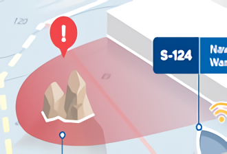
S-124Navigational Warnings

Not Publish
S-125Marine Navigational Services
S-125(Marine Navigation Service) describes the characteristics of the voyage, including lighting and other navigation aids, and messages from local AIS applications.
S-126Marine Physical Environment
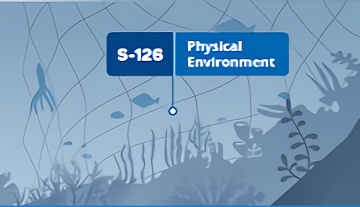
S-126 (Marine Physico-Environment) describes marine and terrestrial topography, seasonal and harmful currents, tides, weather, and other environmental conditions.
S-127Marine Traffic Management
S-127 (Marine Traffic Management Environment) is a standard for ship's traffic service, waterway guidance, route system, and ship position notification system.
S-128Catalogue of Nautical Products

S-128 (Hydro-Bibliographic Catalog) is a standard for the exchange of hydrographic bibliographic information. It includes information on printed and digital water books, online resources, and metadata.
S-129Under Keel Clearance Management
Encodes information about a vessel's under keel clearance for use in managing the safe passage through shallow waters.