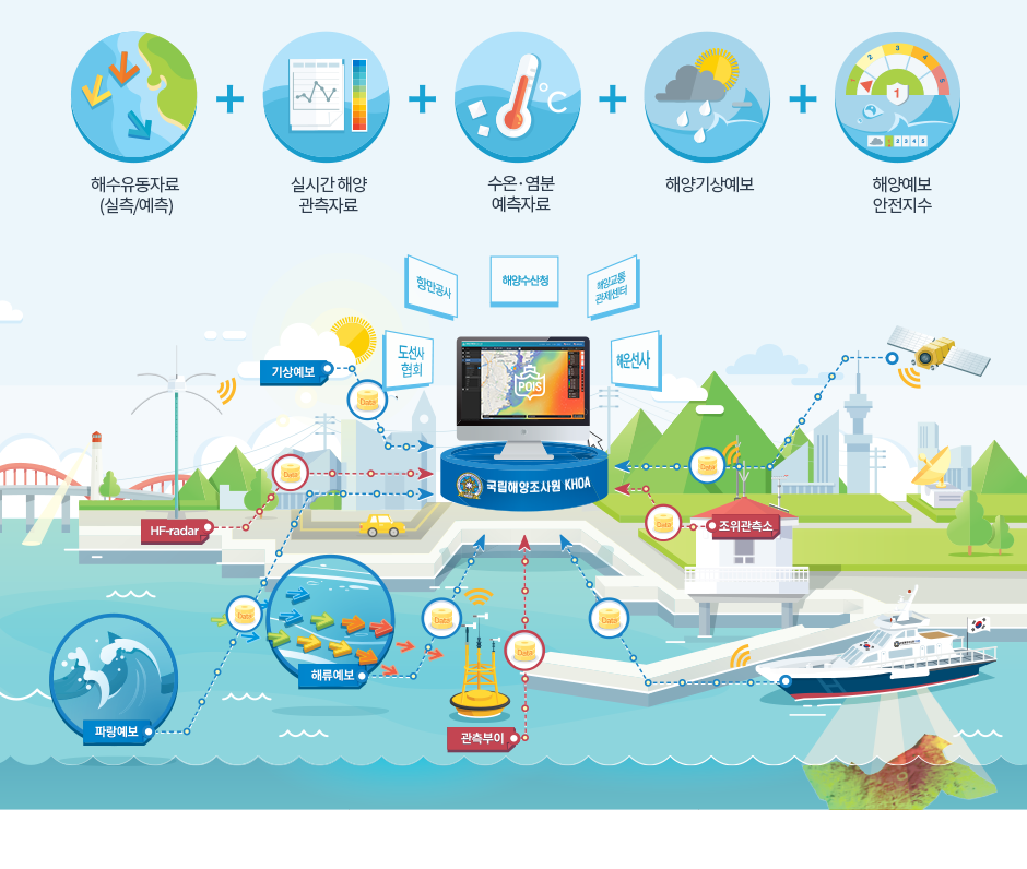
System Introduction

Port Safety Ocean Information System

Port Safety Ocean Information System will provide ocean information essential for the prevention of port accidents and rapid response to accidents and traffic on the basis of various ocean information, weather prediction, measurement data collected and produced by KHOA.

시스템구성 시스템 주요기능 소개 발전방향 및 향후계획

부산항(신항) 조위관측소 (조위)

data save
Date Time 실측조위 (cm) 예측조위 (cm)

(Wind speed/direction)

data save
Date Time Direction Speed ()

조위

data save
Date Time 실측조위 (cm) 예측조위 (cm)

Current speed/direction

data save
Date Time Direction Speed ()

Water temperature/salt

data save
Date Time Water temperature (℃) salt (PSU)

Atmospheric pressure at sea surface

data save
Date Time Atmospheric pressure at sea surface (hPa)

Wave height/Wave period

data save
Date Time Wave height(m) Wave period(sec) Wave direction

Wind speed/direction

data save
Date Time W.Direction W.Speed(kn)

Water temperature

data save
Date Time Water temperature (℃)

Port Marine Index

data save
Date Time index

Current speed/direction

data save
Date Time Direction Speed

Dynamic water depth

Real-Time Bridge Height

Date Bridge Height(m)

Data from Weather Data

recent Time of observation
Wind speed/directionWind speed/direction 남남서 / 3(m/s) TemperaturesTemperatures 22. atmatm 30(hPa)
visibilityvisibility 3m humidity humidity 30% Water temperatureWater temperature 17.1

※ You can see a graph of the time icon selection.

Wind speed/direction graph


Selection Time
  --  :00
HomepageCopyright Policy
Time of observation - Visibility -
HomepageCopyright Policy