Smallest but more functional
second oldest station
Sinangageocho Ocean Research Station
About the Station
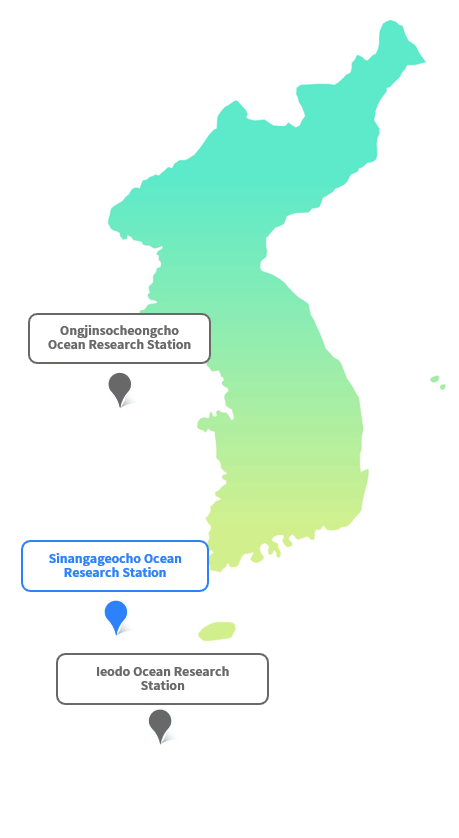
The Sinangageocho Ocean Research Station is located in the southern part of the Yellow Sea. The Yellow Sea is highly crucial for observation because various marine and meteorological phenomena and the substance of air from the sea affect the ROK by westerly winds. In particular, the Station helps understand the impact of fine dust, which is an emerging environmental concern in the ROK. Since the Yellow Sea is at an important location for maritime transportation, it plays an essential role in securing safe sea routes and mitigating marine disasters through ocean and weather prediction.
-
Location and History
-
Main Functions
-

Support for atmospheric and oceanic research through comprehensive observation from the station
-

Provides real-time weather, ocean and atmospheric environment information
-

Helps mitigate disasters by improving the accuracy of ocean and climate prediction
-
-
About the Sinangageocho Ocean Research Station
-
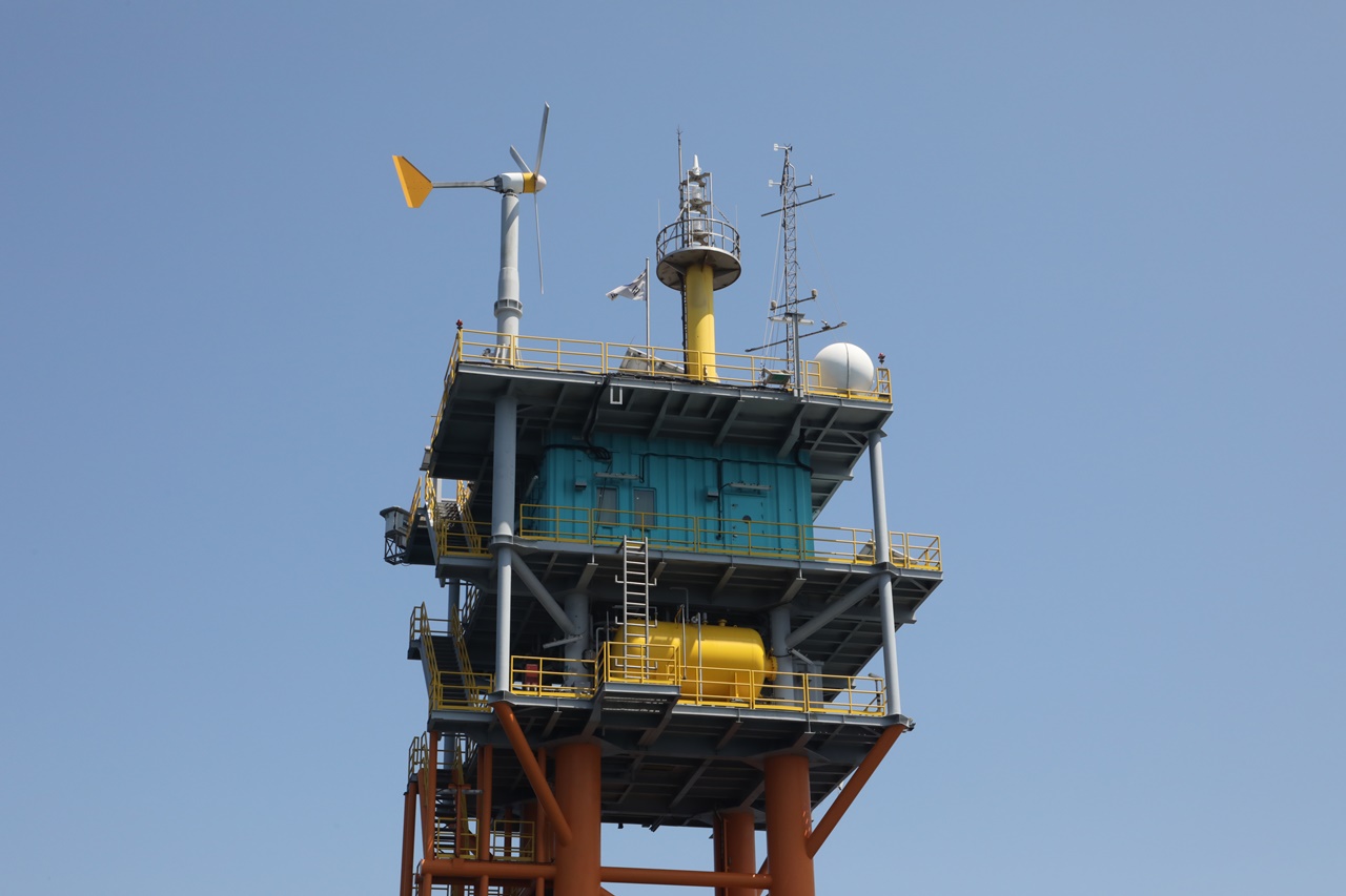
Structure
Height: 46 m (31 m above water, 15 m underwater)
Weight: 640 tons
Size: 286 m2 -
Design Condition
Life: 50 years
Reference Wave Height: 20.95 m
Reference Wind Velocity: 38.7 m/s in average
Reference Tide Level: 2.948 m
Reference Tidal Current: 2.832 m/s -
Main Facilities
Roof Deck
- Location: Datum level (DL) + 31.2 m
- Main facilities: Solar power facilities, lighting equipment, ocean and weather observation equipment, satellite and communication equipmentMain Deck
- Location: DL + 26.7 m
- Main facilities: Residential area, electrical room, main control roomCellar Deck
- Location: DL + 22.2 m
- Main facilities: Electric generator, oil tankIntermediate Deck
- Location: DL + 10.2 m
- Main facilities: Facilities for operating underwater observation equipment
-
-
History
-
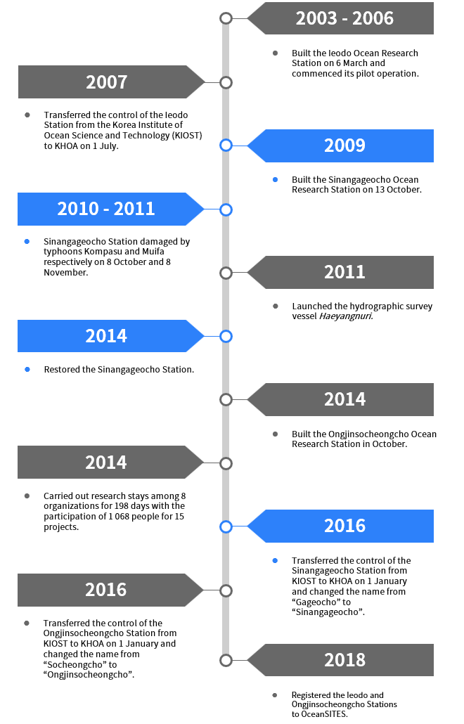
On 29 March 1927, during the colonial period by Japan, the Japanese battleship Hyūga hit this reef and sank, making its existence known. Having made a thorough investigation after the accident, the Japanese military named it Hyūga shou after the sunken ship. Then in December 2006, the Korea Committee on Marine Geographical Names named it “Gageocho” in accordance with the request of the residents of Gageodo to change the name.
-