 HOME
>
OPEN API
>
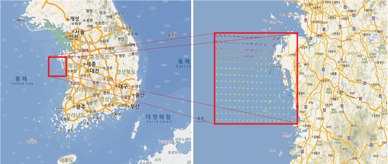
면(지역)단위 수치조류도 예측 유향 유속 (GeoJson)
- 설명 수치조류도 예측 유향,유속 을 검색한날짜 및 영역에 해당되는 데이터를 조회한다.
- 분류 해수유동 > 해양예측-예보
- 요청주소 http://www.khoa.go.kr/api/oceangrid/DataType/search.do?ServiceKey=인증키&Date=검색날짜&Hour=검색시간&Minute=검색시간(분)&MaxX=검색영역(최대경도)&MinX=검색영역(최소경도)&MaxY=검색영역(최대위도)&MinY=검색영역(최소위도)&Scale=해상도
- 비고 화살표 간격이 시스템 부하를 고려하여 지도 축척에 따라 (1,2,4,8,16km)로 자동 조절되어 데이터가 제공되고, 제공 데이터 형식은 GeoJson 포맷으로 제공된다. 아래에 작성된 예제는 OpenLayers 적용 기준으로 작성되었습니다.
관측소 목록
※ 본 API에서 제공하는 수치조류도 영역을 조회할 수 있습니다
다운로드

| 항목명(영문) |
항목명(국문) |
샘플데이터 |
비고 |
| DataType |
데이터 종류 |
tidalCurrentAreaGeoJson |
|
| ServiceKey |
인증키 |
wldhxng34hkddbsgm81lwldhxng34hkddbsgm81l== |
|
| Date |
검색날짜 |
20160105 |
|
| Hour |
검색시간 |
05 |
00 ~ 23시간 |
| Minute |
검색시간(분) |
15 |
00 ~ 59분 |
| MaxX |
검색영역(최대경도) |
126 |
|
| MinX |
검색영역(최소경도) |
122 |
|
| MaxY |
검색영역(최대위도) |
37 |
|
| MinY |
검색영역(최소위도) |
32 |
|
| Scale |
해상도 |
4000000 |
|

GeoJson(출력결과)
-
{
"type":"FeatureCollection",
"features": [{
"type":"Feature",
"properties": {
"lat":36.99556,
"lon":125.06,
"current_direct":-209,
"current_speed":45.9,
"strokeOpacity":1,
"fillOpacity":1,
"strokeWidth":1.2,
"pointRadius":3,
"fillColor":"#FF6000",
"strokeColor":"#FF6000"},
"geometry":{
"type":"Polygon",
"coordinates":[[
[125.05955 , 36.99473],
[125.01349 , 37.01974],
[125.01919 , 37.01060],
[125.00569 , 37.02503],
[125.02515 , 37.02158],
이하생략

REST(URL)
적용예제(OpenLayers)
-
/*좌표계변환설정*/
var geojson_format = new OpenLayers.Format.GeoJSON(
{
'internalProjection': new OpenLayers.Projection("EPSG:900913"),
'externalProjection': new OpenLayers.Projection("EPSG:4326")
});
/*속성정보에 포함된 스타일링 적용설정*/
var vector_template = new OpenLayers.StyleMap(
{
"default": new OpenLayers.Style(
{
fillColor: '',
strokeColor: '',
strokeOpacity: '',
fillOpacity: '',
strokeWidth: '',
pointRadius: ''
})
});
var vector_layer = new OpenLayers.Layer.Vector(
"geoJson", //레이어명칭
{styleMap: vector_template} //스타일 적용
);
map.addLayer(vector_layer); //레이어 추가
vector_layer.addFeatures(geojson_format.read(GeoJson)); //GeoJson 레이어에 추가


