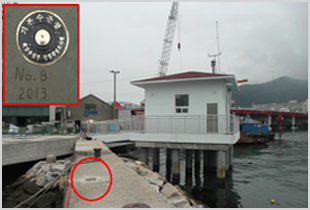
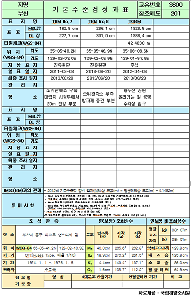
Tidal Bench Mark Surveys
The 'tidal bench mark survey' is designed to manage the tidal bench mark laid under the ground based on tidal observation in order to set standards for measuring water depths and heights during hydrographic surveys. The purpose is to survey heights and longitude and latitude coordinates from base levels (datum level and average sea level) by means of tidal observations.