-
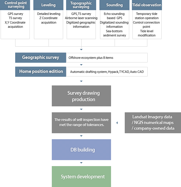
Control point surveying
-
GPS survey
-
TS survey
-
Coordinate acquisition
-
Leveling
-
Detailed leveling
-
Z-coordinate acquisition
- Topographic surveying
- GPS/TS surveys
- Airborne laser scanning
- Digitized geographic information
-
Sounding
- Echo sounding based
- Digitalized sounding information
- Sea-bottom sediment survey
- Tidal observation
- Temporary tide station operation
- Control connection point
- Tide level modification
- Geographic survey
- Offshore ecosystem plus 8 items
- Home position edition
- Automatic drafting system, Hypack, TYCAD, Auto CAD
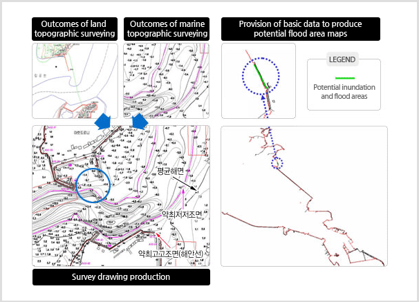
Survey drawing production
The results of self-inspection have met the range of tolerances
Landsat imagery data
NGIS numerical maps
company-owned data
Database development
System development