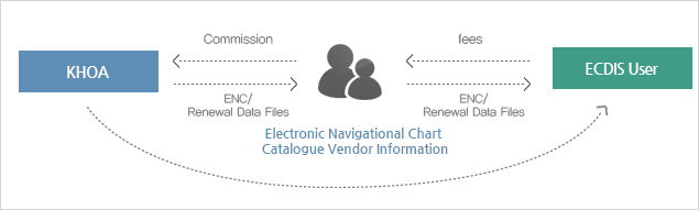
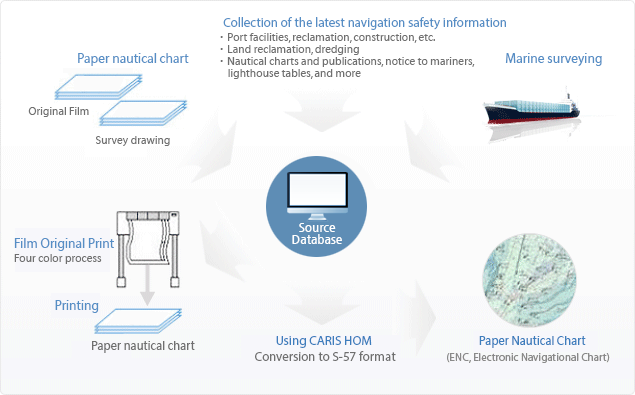
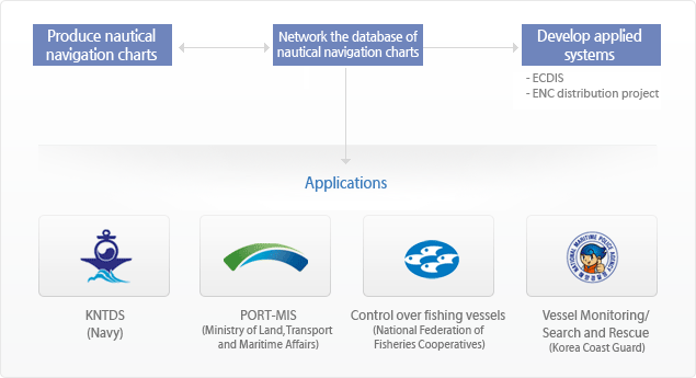
ENC: Electronic Navigational Chart Definition
An electronic navigational chart is a digital chart. In accordance with the IHO Transfer Standard for Digital Hydrographic Data (S-57), this chart covers all information on paper charts related to marine navigation, such as coastlines, isobaths, water depths, beacons (lighthouses and light buoys), hazards, and sea routes, in order to apply the aforementioned data to the Electronic Chart Display and Information System (ECDIS).