01
Define and manage sea routes, navigable ways, which vessels use for safe navigation.
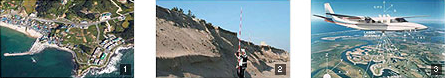
By surveying main ports and watercourses in detail and producing nautical charts, we support vessels’ safe navigation and people’s marine activities. Also, we produce the electronic navigational chart (ENC), marine navigation.
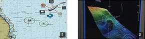
- 1 Produce nautical charts and provide navigation information
- 2 Manage sea-bottom configurations such as a reef
- 3 Issue notices to mariners and navigational warnings
02
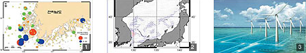
We delimit maritime territories and seek to develop ocean resources in the changing international situation.
We collect scientific information so as to hold a dominant position in the competition for expanding the maritime territory and securing resources, including the EEZ and the continental shelf. We also manage the territorial base point, the standard of delimitation with neighboring countries, and promote the international use of the East Sea and the international registration of Korean marine geographical names.
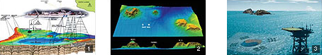
- 1 Conduct surveys for basic maps of the national sea
- 2 Produce the 3-D bathymetric chart of the East Sea
- 3 Manage Dokdo and Ieodo waters
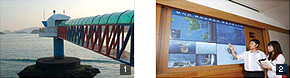
- 4 Spread and promote the use of the East Sea
- 5 Register Korean undersea feature names in the Pacific Ocean
03
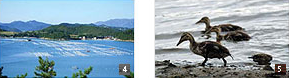
Strive to protect people’s lives and property against marine disasters and promote sustainable development even in climate change.
We operate the oceanographic observation network and the Ieodo Ocean Research Station; forecast and alert risks early, including tsunamis and abnormal waves; monitor sea level rise caused by global warming; and prevent marine disasters by predicting coastal erosion and flooding.
- 1 Operate the oceanographic observation network
- 2 Run forecast/alert systems
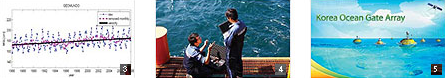
- 3 Analyze the rate of sea level rise
- 4 Monitor climate change such as water temperatures
- 5 Perform the KOGA Project
04
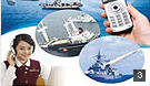
Provide information on military operations in order to safeguard our marine territory.
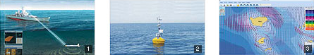
We provied information by surveying the topography of the waters of operations and observing marine phenomena. We also produce nauticl charts used for naval operations, and forge integrated marine/meteorological information systems for operations.
- 1 Survey topography of the sea areas adjacent to other sea areas
- 2 Observe the marine area of operation in real time
- 3 Forge tidal forecast information systems
- 4 Determine the period of marine operations
- 5 Develop integrated systems for operations
05
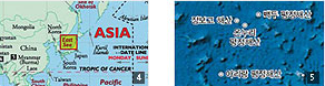
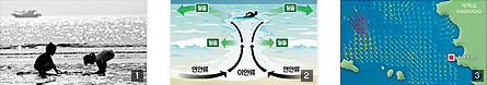
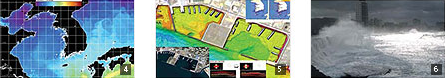
Support marine policies for efficient use/development/preservation of our seas.
We investigate and manage offshore environments comprehensively, such as coastlines, foreshores, reefs, uninhabited islands, the environments. We also protect people's ownership and settle disputes by surveying sea borders.
- 1 Investigate and manage coastal lines
- 2 Monitor coastal erosion
- 3 Survey uninhabited islands remotely
- 4 Survey sea borders
- 5 Investigate marine ecosystems and the ocean environments
06
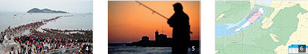
Support people’s marine leisure activities
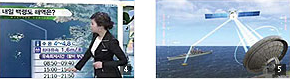
We forecast tide time for safe foreshore experiences. We protect people’s lives by investigating the offshore currents of beaches, and providing marine information needed in sea parting, yachts, swimming, fishing, and more so as to improve people’s lives.
- 1 Forecast tide time
- 2 Investigate the offshore currents of beaches
- 3 Provide real-time information about seacoasts
- 4 Forecast sea parting
- 5 Produce the table of offshore currents for fishing
- 6 Produce maps of yachts and beaches
07
Develop marine science and technology for green growth.
- 1 Produce tidal energy resource charts
- 2 Conduct research for ocean currents in the East Sea
- 3 Select suitable places to develop marine energy
- 4 Analyze and predict abnormal phenomena
- 5 Model changes of submarine landforms
- 6 Analzye and predict abnormal phenomena
08
Advanced to become a marine technology power house through international exchanges and cooperation.
We take the lead in marine technologies through technical exchanges and cooperation with international organizations and advanced countries, including IHO, ICO, and GEO. Moreover, we transfer our marine techniques and experiences to developing countries so as to promote the national brand power and contribute to the international community.