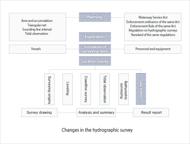
Types and Methods
The hydrographic survey is intended to investigate water depths, coastline configuration, rock locations and heights, and submarine geology.
The survey results are recorded in nautical charts and every waterway related publication, for the purpose of the use in the safety of navigation, port construction, and marine development.